
The Israel Defense Forces (IDF) on Friday apologised after it posted a wrong map of India’s international boundaries, showing Jammu and Kashmir as part of Pakistan. After this mistake, the IDF admitted that there was a mistake in accurately showing the borders in the map. But claimed that the map just depicted the area.
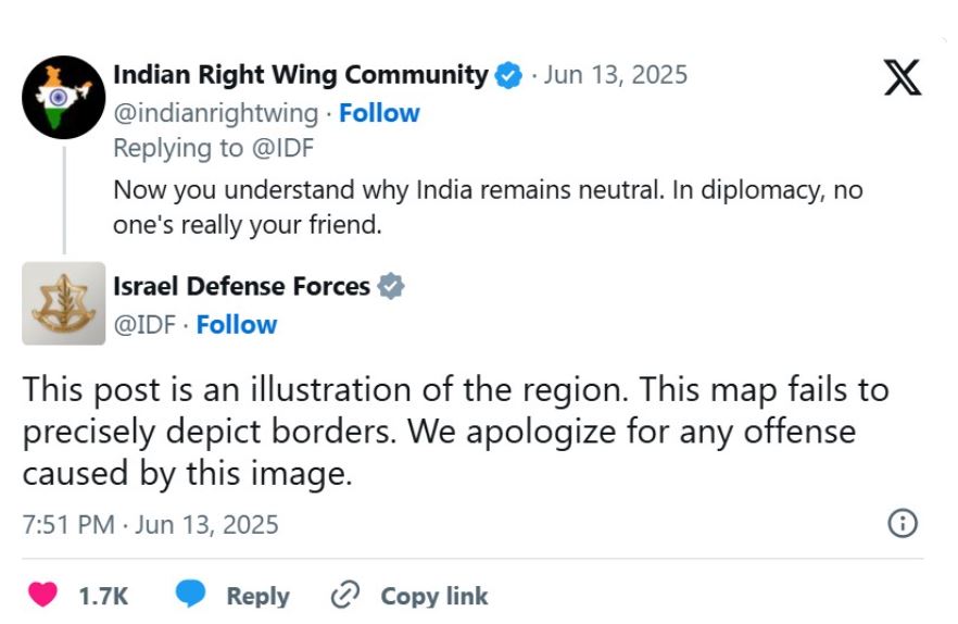
After the IDF post, many Indian users posted angrily and pointed out the IDF’s mistake and asked the Israeli army to take down the post. The Israeli army responded to a post from an X handle called Indian Right Wing Community, saying, “This post is a depiction of the region. There was a mistake in showing the boundaries on the map. We apologize for any offense caused.”
India has always maintained that Jammu and Kashmir and Ladakh, parts of which have been illegally occupied by Pakistan and China for decades, are and will always remain an integral part of the country.
PM Modi had reiterated the same thing after the Pahalgam attack in May and then Operation Sindoor.